






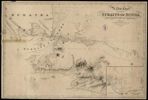
Título: A new chart of the Straits of Sunda : completed from the most recent authorities / / Engraved by James Stevenson
Área de datos: Escala indeterminada
Publicación: London : : published by James Imray & Son, , 1849
Descripción física: 1 carta náutica : : grab. ; ; 65 x 97 cm en h. de 68 x 100 cm
Notas: Orientado con flor de lis.- Meridiano de origen: Greenwich.- Márgenes graduados.- Relieve por normales y sombreado. - Sondas.- HidrografíaLegado Vicente Paredes GuillénSello de la Biblioteca Provincial de Cáceres
Materia / lugar / evento: Sonda (Estrecho)- - Cartas naúticas- - 1849
Género / forma: Cartas naúticas
Nombre jerárquico lugar: Reino Unido - Londres
Otros autores: Stevenson, James Imray, James & Son (fl.1854-1899)
Tipo de publicación:
 Mapas
Mapas
